Arch Viz, 360 Virtual Tours + Architectural Aerial Photography
Ritz Carlton Pompano
Architectural Visualization, 360 Virtual Tours + View Photography in Florida
Drone Genius produces architectural aerial photography, 360 virtual tours, aerial spheres, and backplate capture for architects, developers, hospitality groups, and visualization studios across Florida. Each flight is planned around design intent, view corridors, sun position, surrounding context, and the final use of the imagery.
From award-submission imagery and completed-project portfolios to rendering backplates, sales-gallery assets, and immersive 360 experiences, our aerial work helps architecture and development teams communicate space, scale, views, and context with precision.
Arch Viz + Architectural Aerial Services We Offer
Architectural View Photography
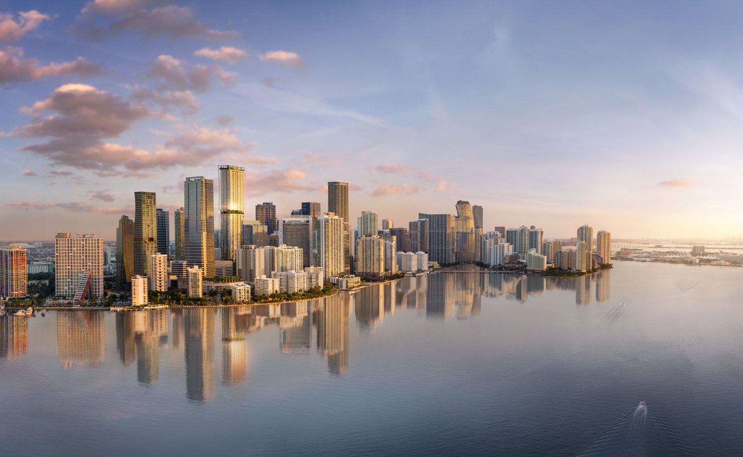
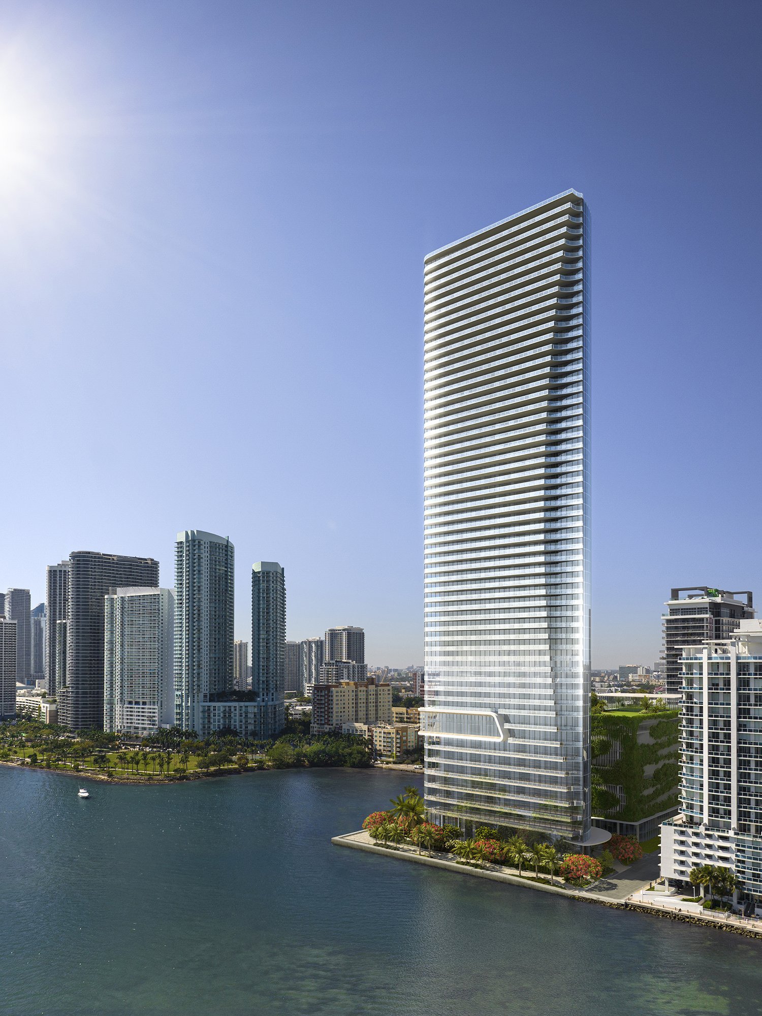
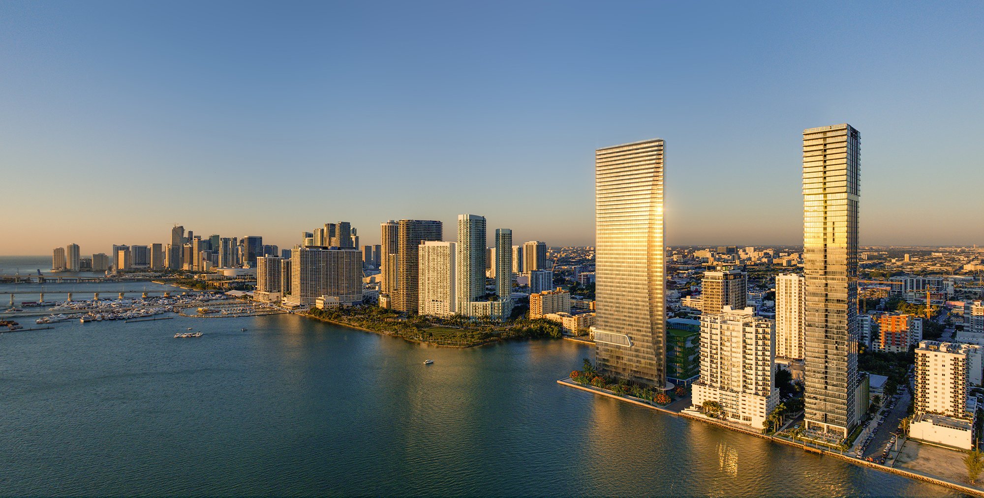
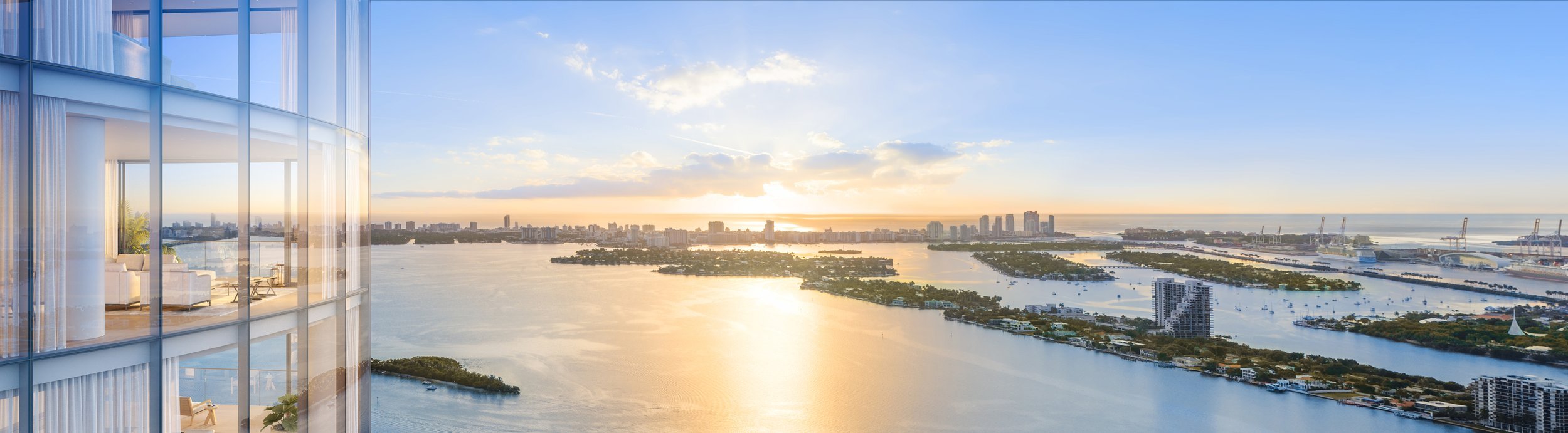
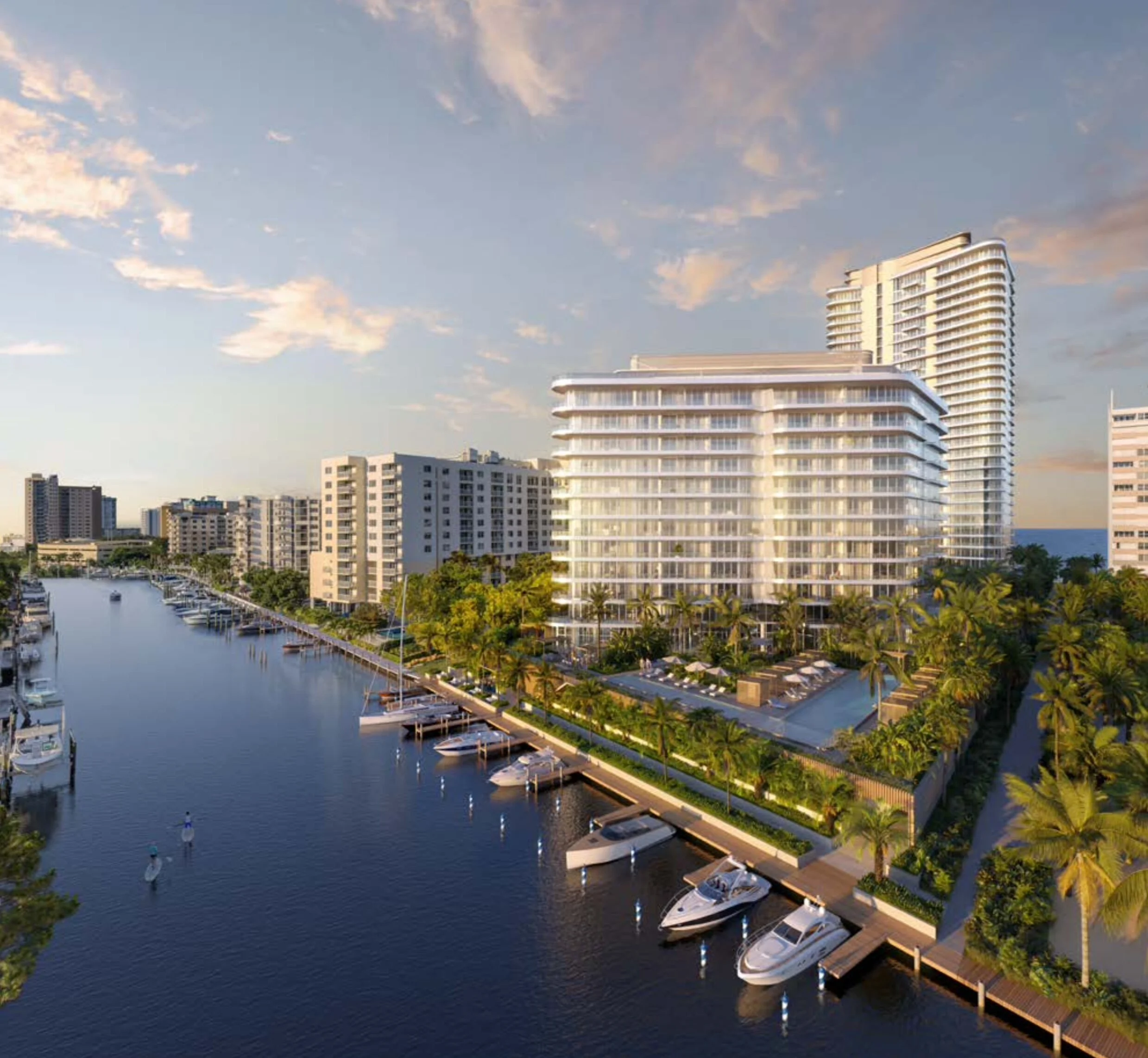
High-resolution aerial stills captured from deliberate elevations, bearings, and focal lengths to show the relationship between a building, its views, waterfront context, streetscape, neighboring landmarks, and landscape design.
Site Progress + Development Documentation
Scheduled aerial capture throughout design development and construction helps firms document context, track progress, support stakeholder updates, and build a visual record from site conditions through completion.
Aerial Cinematography for Architecture + Hospitality
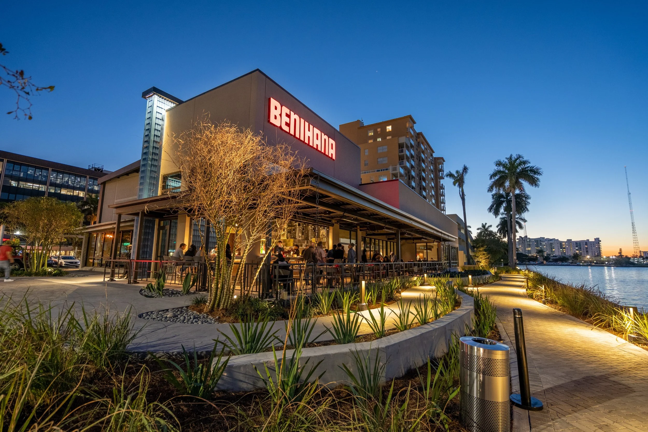
Cinematic aerial video gives architecture, hospitality, and mixed-use projects a sense of movement, arrival, and scale. We build sequences for firm websites, project launches, leasing decks, awards, and investor presentations.
360 Virtual Tours and Site Context
Interactive 360-degree aerial captures that provide a complete view of the project and its surroundings. These virtual tours are especially useful for communicating site context, views from different elevations, and the relationship between indoor and outdoor spaces.
Backplate Capture + Rendering Support
Backplate capture provides visualization teams with accurate aerial perspectives, view angles, skyline context, sun direction, and site conditions for CGI, compositing, sales galleries, and pre-construction marketing.
FPV Architectural Walkthroughs
First-person-view drone flights that create immersive, continuous-shot videos moving through and around architectural spaces. FPV footage captures the flow and spatial experience of a building in a way that static photos and traditional video cannot replicate.
Why Architecture Firms Choose Drone Genius
Design Sensitivity: We understand how architects think about space, light, and context. Our pilots frame shots that emphasize design intent, material expression, and spatial relationships rather than simply flying overhead.
Publication-Quality Imagery: Our images meet the standards required for architecture publications, award submissions, AIA entries, and portfolio presentations.
FAA-Certified and Insured: All pilots hold current Part 107 certifications and carry full liability insurance, ensuring compliance on every project site.
Professional Equipment: We fly DJI and custom platforms with high-resolution cameras, delivering sharp, color-accurate imagery in RAW and edited formats.
Statewide Coverage: We serve architecture firms throughout Florida, including Miami, Fort Lauderdale, West Palm Beach, Naples, Tampa, Orlando, and Jacksonville.
Frequently Asked Questions
What types of architectural projects do you photograph?
We photograph residential, commercial, institutional, hospitality, and mixed-use projects of all scales. From single-family homes and boutique hotels to high-rise towers and master-planned communities, we adapt our approach to the design and context of each project.
Can you coordinate with our photographer or marketing team?
Absolutely. We regularly collaborate with architecture photographers, marketing directors, and PR teams to ensure our aerial coverage complements the overall visual strategy for the project.
Do you provide RAW files for post-production?
Yes. We deliver both professionally edited final images and RAW files for firms that prefer to handle their own post-production or need files for rendering composites.
How do you handle drone flights near airports or restricted areas?
We hold all required FAA authorizations and file LAANC airspace requests for every flight in controlled airspace. We coordinate with local authorities and follow all regulations to ensure safe, compliant operations at every project site.
Ready to capture your architectural project from a new perspective? Call Drone Genius today at (786) 292-8220 or contact us online to schedule your shoot.
Edition Residences Edgewater
Architecture and visualization teams choose Drone Genius for production-grade planning, controlled flight repeatability, clean files, and a practical understanding of how aerial imagery is used in awards, renderings, 360 experiences, leasing decks, and developer presentations.
Our work spans completed architecture, hospitality projects, waterfront developments, branded environments, backplate capture, and immersive commercial-space documentation across South Florida and statewide markets.
360 virtual tours and aerial spheres give developers, architects, hospitality teams, and visualization studios a clearer way to communicate views, site context, arrival sequence, and future project experience without forcing stakeholders to parse a loose folder of files.
Clients including West Elm, Nissan, Dior, Brita, Good Morning America, and other national brands have trusted Drone Genius when aerial work needed to feel polished, controlled, and production-ready. Schedule a Production Consultation to scope architecture, 360, or visualization capture.
Architecture, Arch Viz + 360 Capture Across Florida
Drone Genius supports architecture, development, hospitality, and visualization teams across Florida. Core markets include:
Architectural aerial capture in Miami
Architectural aerial capture in Fort Lauderdale
Architectural aerial capture in West Palm Beach
Architectural aerial capture in Naples
Architectural aerial capture in Tampa
Architectural aerial capture in Orlando
Architectural aerial capture in Jacksonville
What are you waiting for? Let’s talk over the details of your project and figure out if we are a good fit for what you’re looking for. You’ll be glad you went with the Drone Genius.
Edition Residences Edgewater
Edition Residences Edgewater

Ora by Casa Tua

Ora by Casa Tua

Ora by Casa Tua

Foster + Partners | SHVO

Foster + Partners | SHVO

Foster + Partners | SHVO

Cove Miami

Cove Miami

Ritz Carlton Pompano
Ritz Carlton Pompano

Ritz Carlton Pompano

Ritz Carlton Pompano

Link at Douglas
VIZCAYA STATION

Final Rendering for Vizcaya Station

Original aerial backplate image used for photo realistic 3D Rendering.